Plantation to Plant transformation in Gramercy
Mt Airy to ATALCO Transformation in Gramercy
Drag the bar to explore this map over time.
New rare earth plant will increase pollution impacts
Exploratory Map

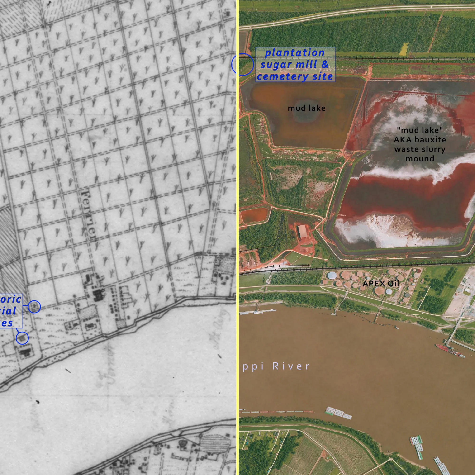
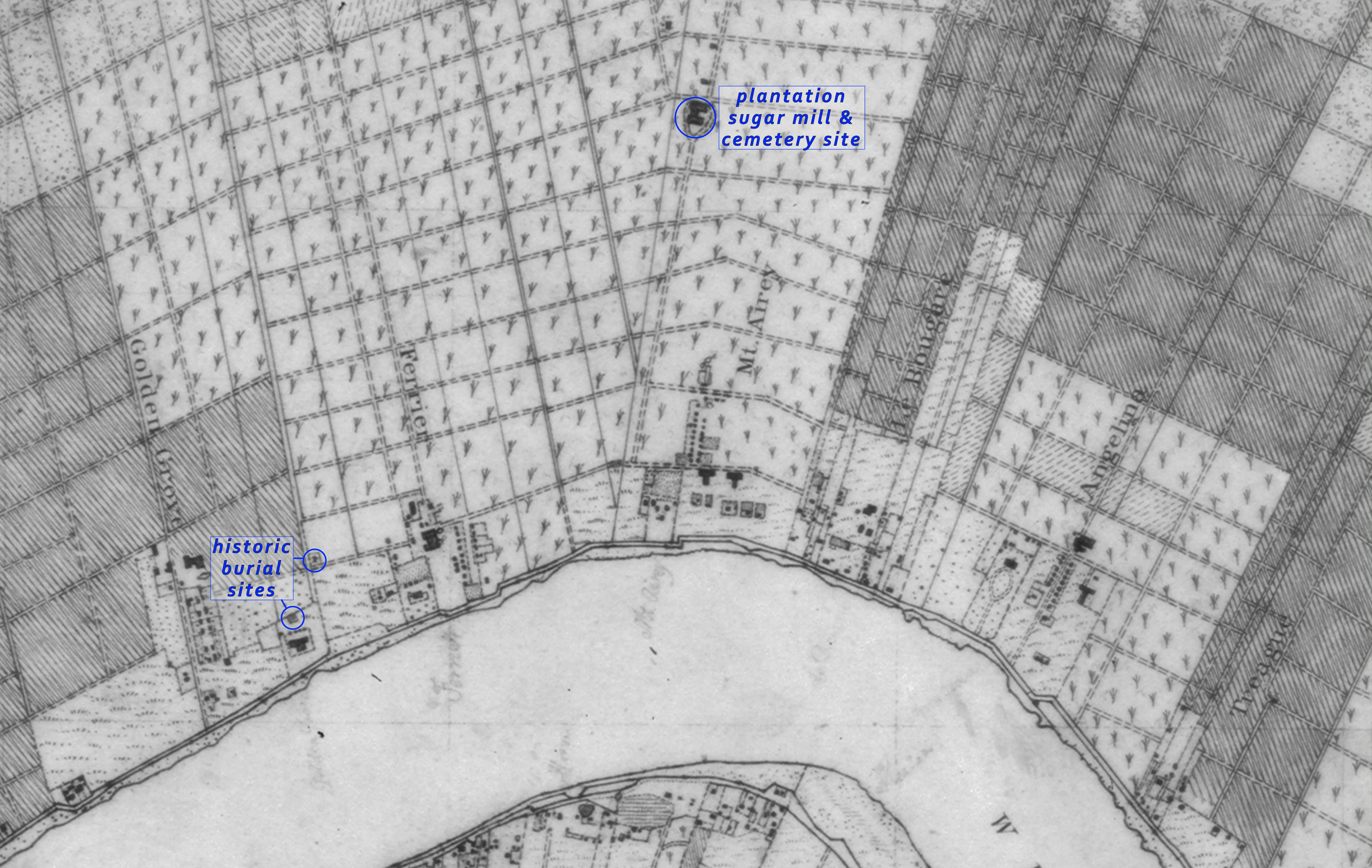
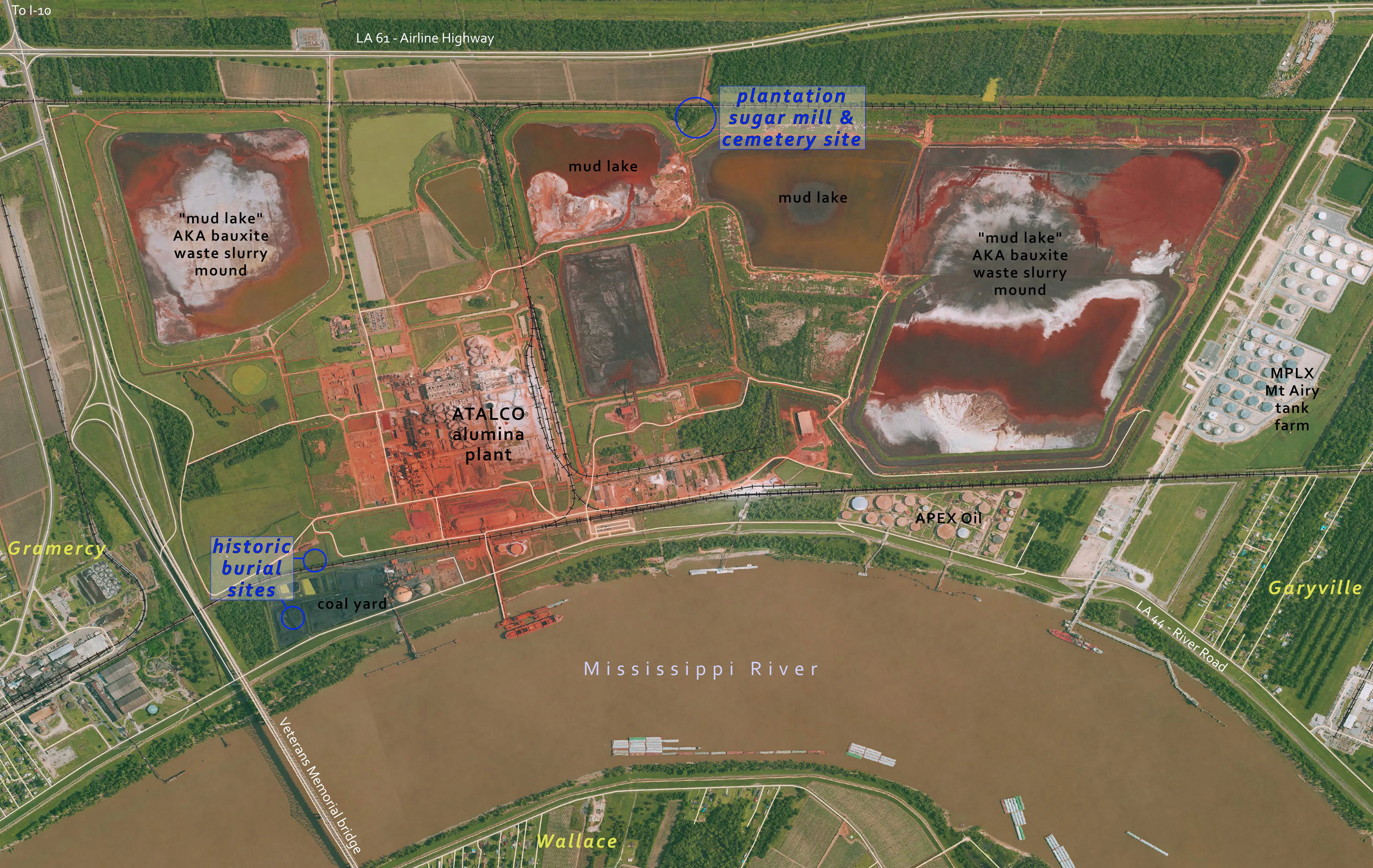
Cartographic regression using archival maps from 1877
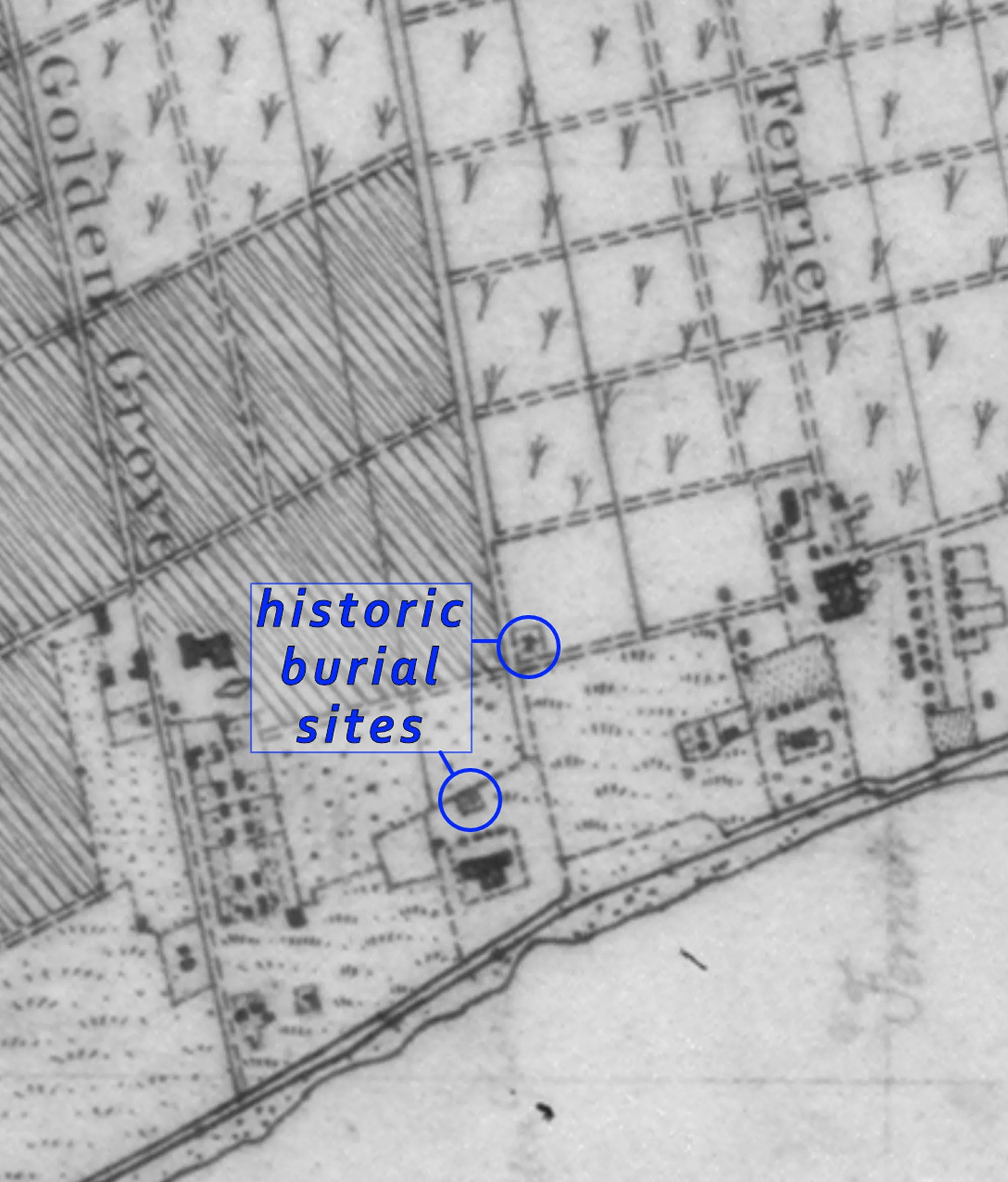
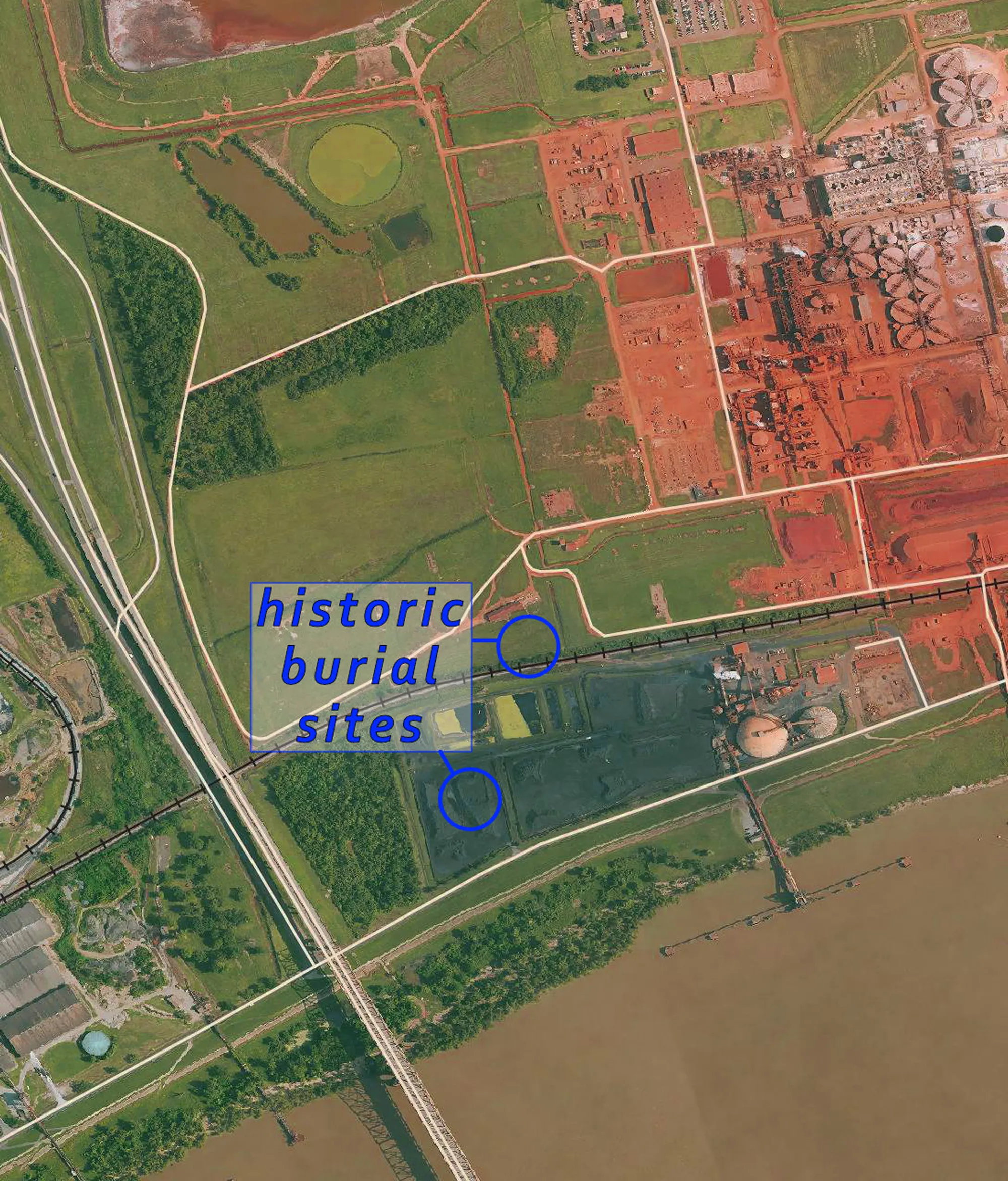
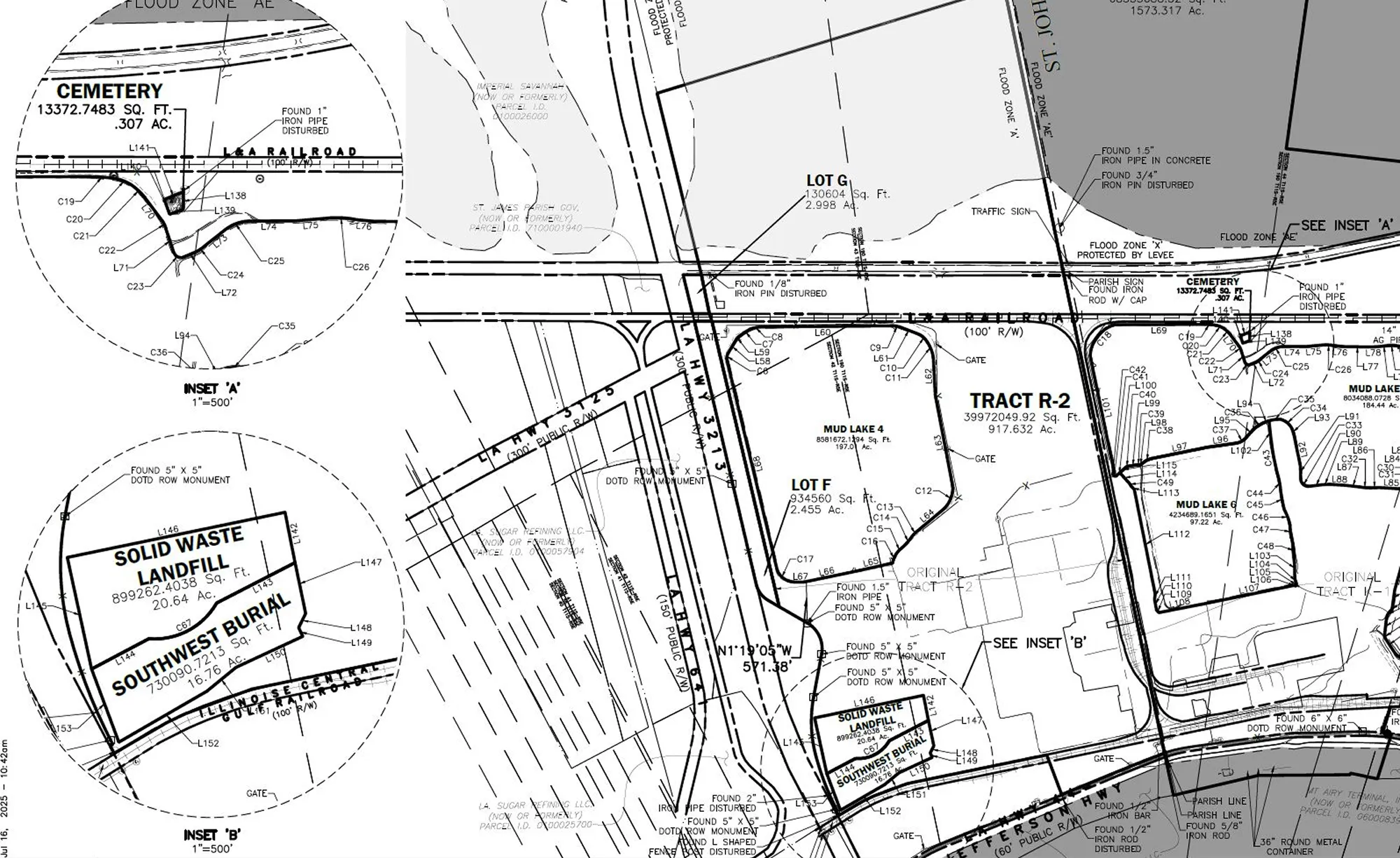
The 1877 US Coast Survey, commissioned after the Civil War, contains a wealth of information about features of the landscape along the Mississippi. The surveyors took detailed notes of the landscape, including predominant crops grown, built structures, and very importantly, the locations of human burial sites that are otherwise not registered or well documented on other maps. This archival map has become the go-to resource for discovering important archaeological site information, and locating in the current day using a process of image transpositions and overlays called “cartographic regression”. Field archaeology work is then conducted to confirm locations, the results of which will be published in a Cultural Resources Survey, which is required prior to any ground disturbance for proposed new construction. The 1877 map reveals that there are at least three burial sites within the boundary of the ATALCO property (see Image 1 and 2). This is partially confirmed by a recent subdivision application submitted by the property owner to St James parish planning commission (see Image 3).