Erasing Modeste
Proposed Industrial Development of Modeste
Drag the bar to explore this map over time.
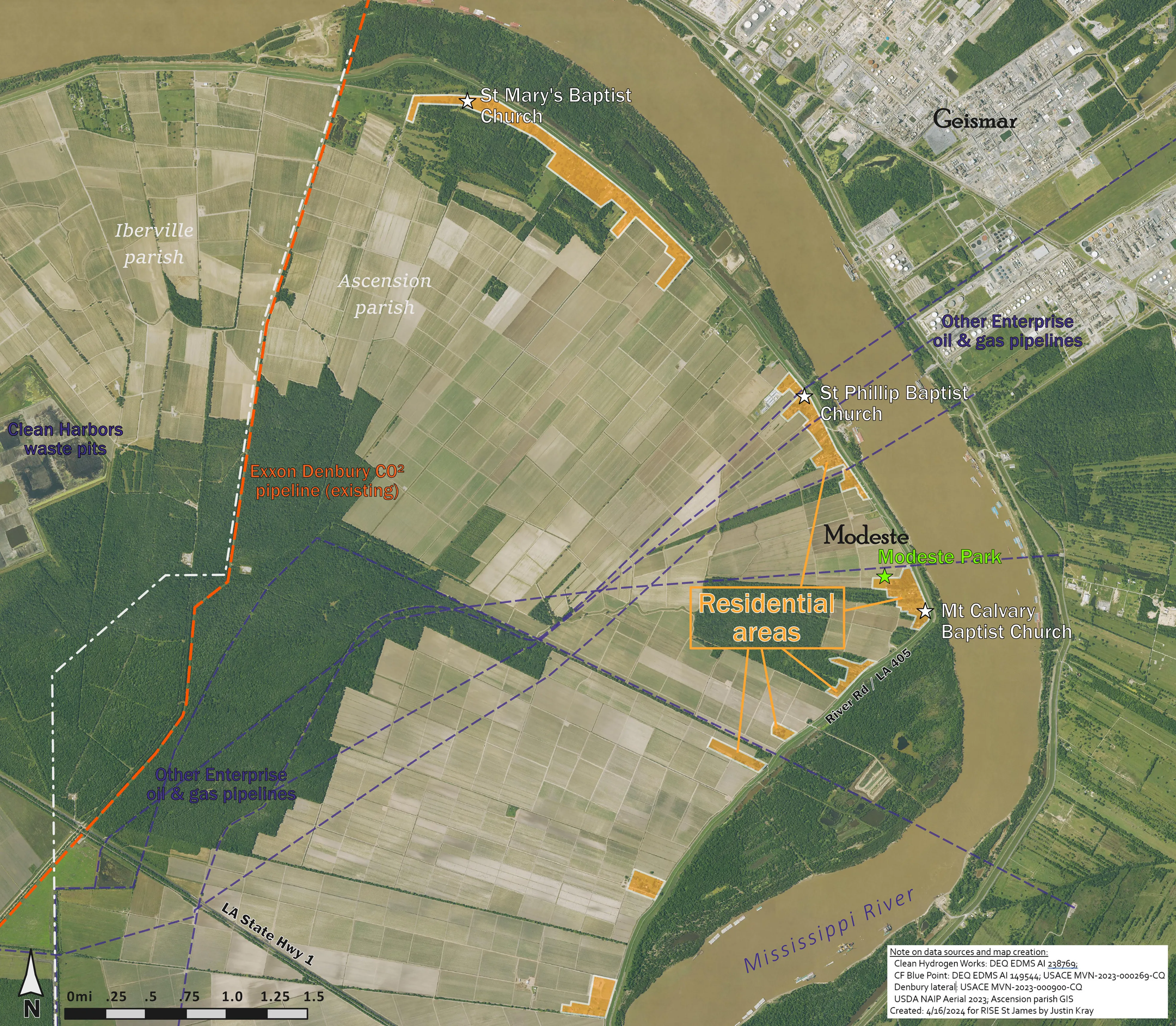
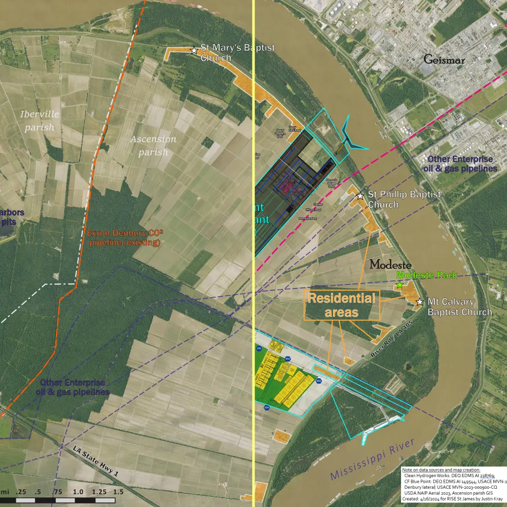
Rural area of Modeste targeted for industrial erasure
Exploratory Map
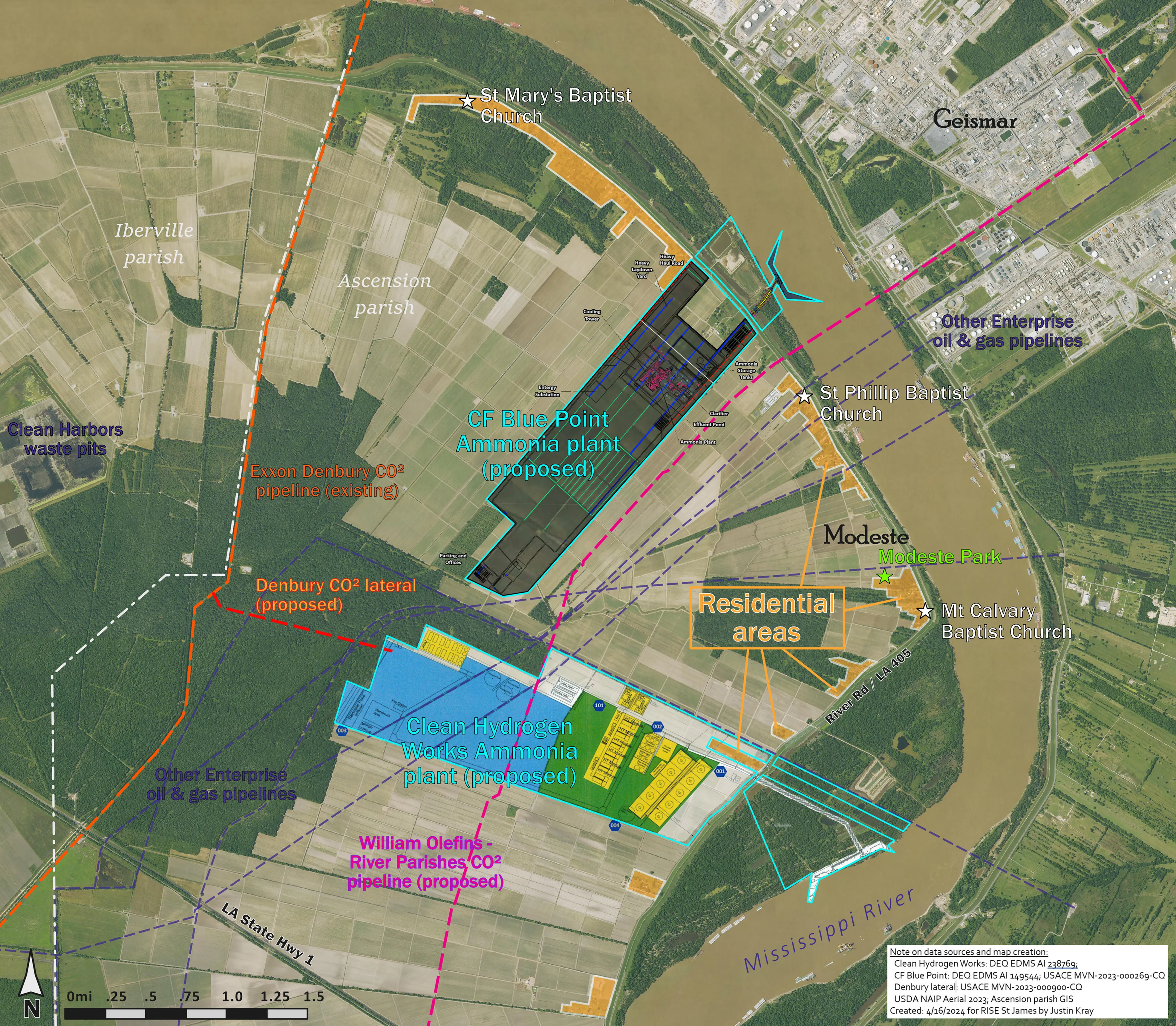
Show residents how they would be surrounded by industry
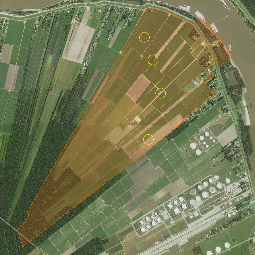
In interviews with residents of Modeste, it became clear that people living in the area were unaware of the scale and impact these proposed new ammonia plants was about to have upon their community, it would surround them on both sides creating an unsafe situation that would potentially leave residents left behind trapped between two highly-hazardous facilities (a residential buyout was not on the table at that time). I create the visual to show as much information as I could gather from the site plan permit drawings that the ammonia plant applicants (CF Blue Point and Clean Hydrogen Works) submitted as part of their state application. I then overlaid all of this information on a high-resolution aerial photograph so that measurements could be taken of the distance of hazardous elements of the industrial plants (such as: flare stacks, ammonia storage tanks, CCS carbon dioxide pipelines). The resulting maps were presented to community members and clergy at a town hall meeting in Donaldsonville as part of RISE St James outreach and organizing efforts.

Organizing effort continues, local group files lawsuit
The breakneck speed at which industry and government has moved to announce new proposals concentrated in this area has challenged local organizers. A few efforts are underway as the extent of potential damage has become clearer, aided in part with the maps I created in 2024. Recently, the organizations Rural Roots and Louisiana Bucket Brigade filed a suit against Ascension parish, claiming that the industrial rezoning of land in Modeste followed improper procedure. Since this map was last updated, two more industrial proposals, DG Fuels and Hyundai steel have been announced for the same area; so an update to this map is expected in the next couple of months.