Air Products’ CO2 Pipeline
Drag the bar to explore this map over time.
Air Products’ Dangerous Pipeline
Exploratory Map
Develop Communication Materials for Community Organizing
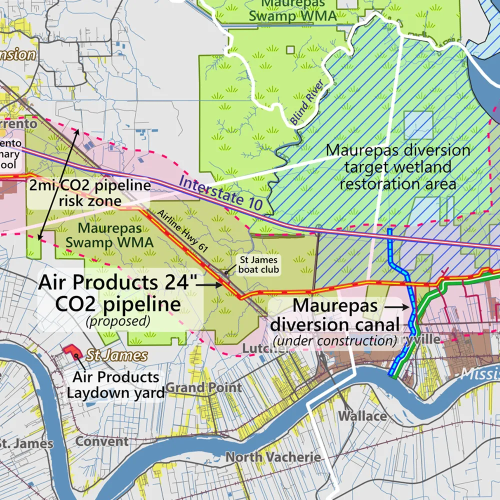
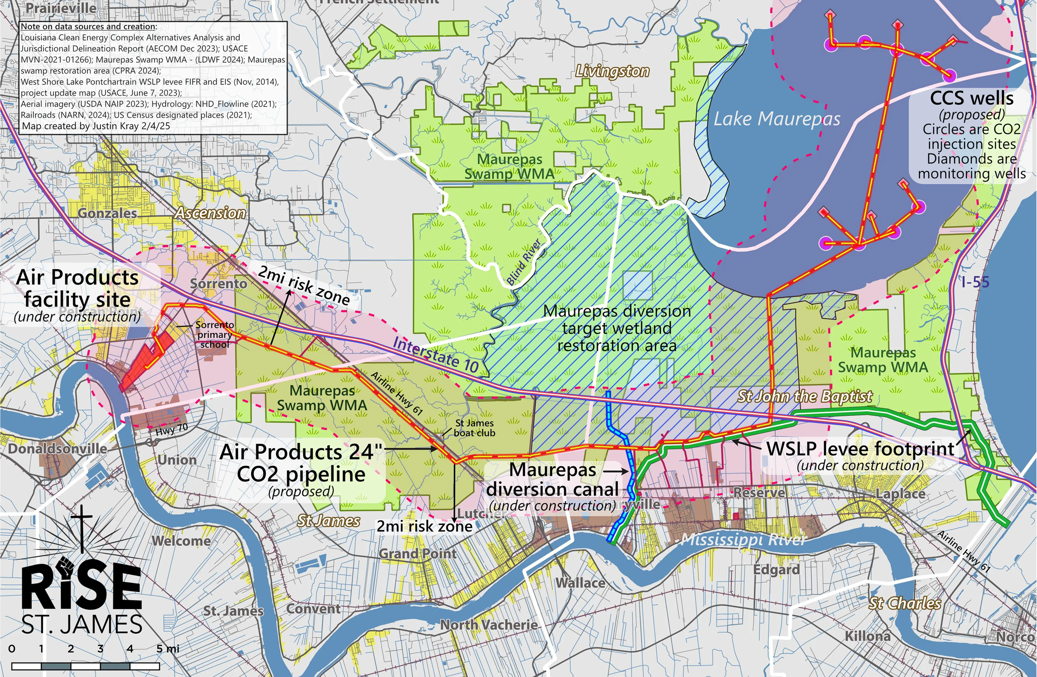
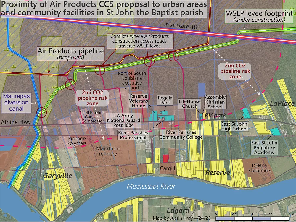
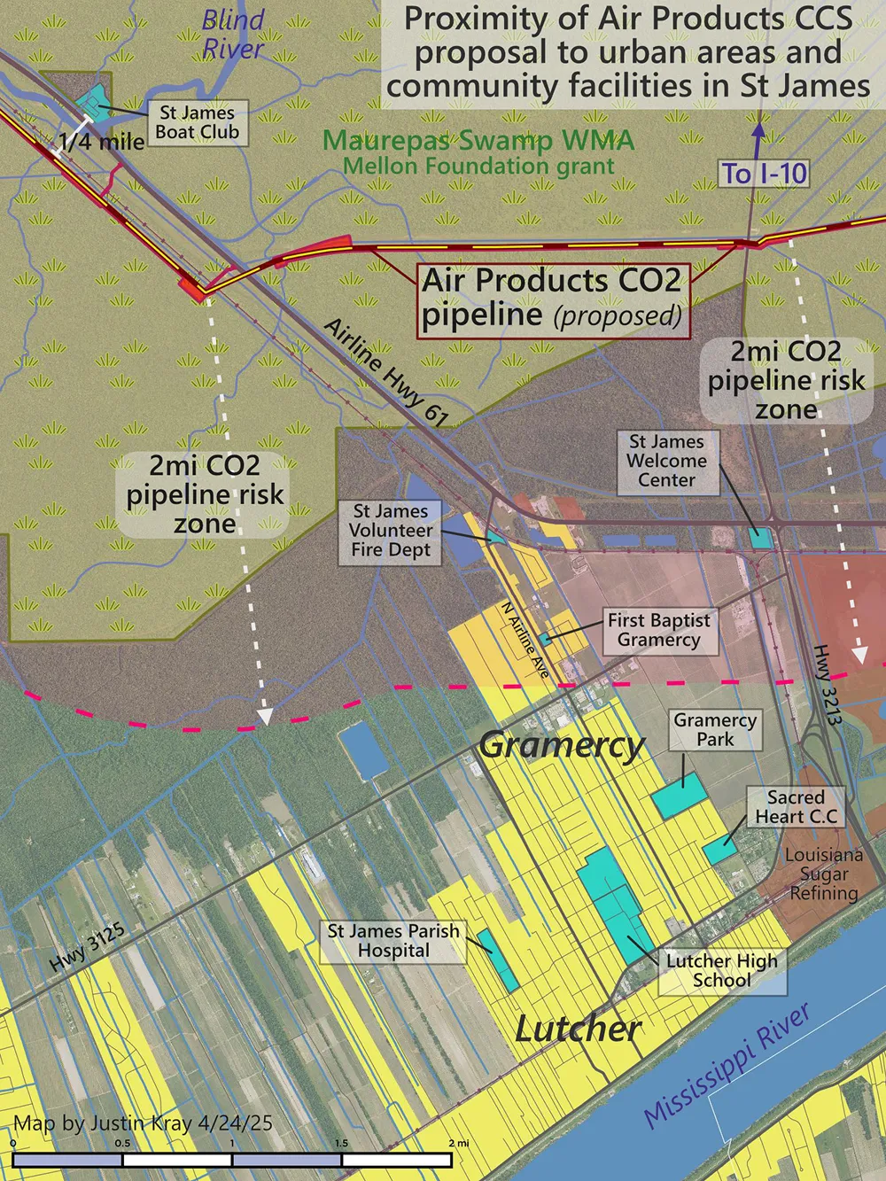
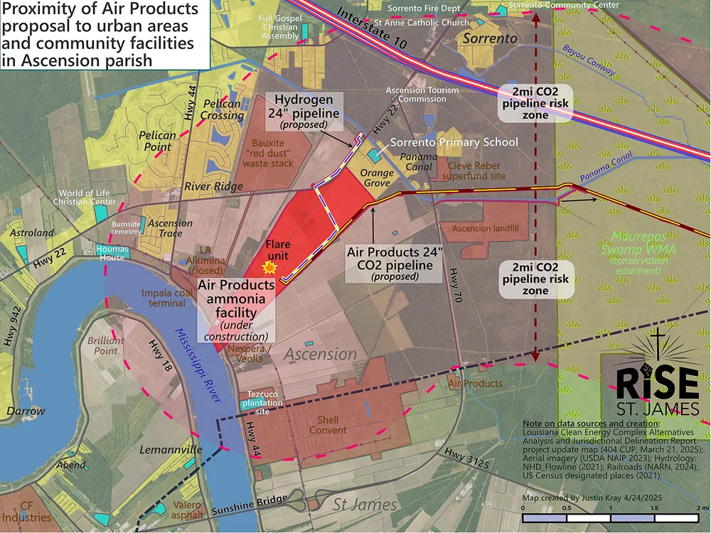
Maps are essential communication tools to drive media messaging and organize community turnout for permit hearings. The first map shows the entirety of Air Products’ dangerous scheme, from the new ammonia plant in Ascension parish, to the 30 mile long pipeline through wetland cypress forests and conservation areas, to the terminus at Lake Maurepas for CCS injection site. Then I created a set of focused proximity maps to highlight areas where the pipeline ran adjacent or near-to inhabited residential areas and community facilities.
Maps Drive Turnout and Engagement
Maps have been a key component of media packets, public outreach briefings, and also legal comments submitted to key regulatory agencies such as the Army Corps of Engineers. The organization has worked to galvanize a growing and diverse coalition of residents, fishermen, boaters, public officials, and even some industry workers, who have attended town-hall meetings to demand a full Environmental Impact Statement (EIS) to evaluate the project.