Exxon CCS Pipeline
Drag the bar to explore this map over time.
Exxon aggressively seeks permits for dangerous pipeline
Exploratory Map
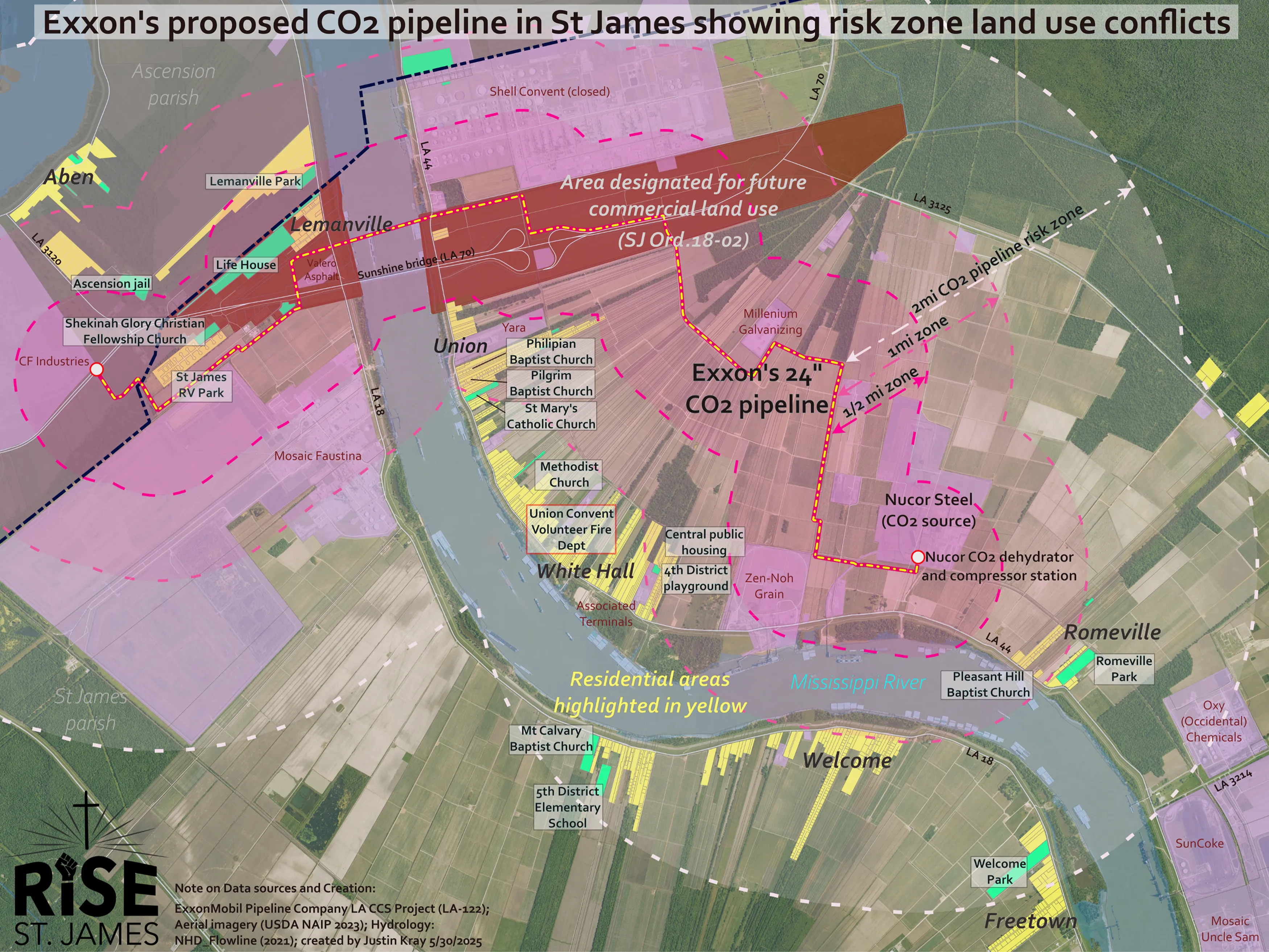
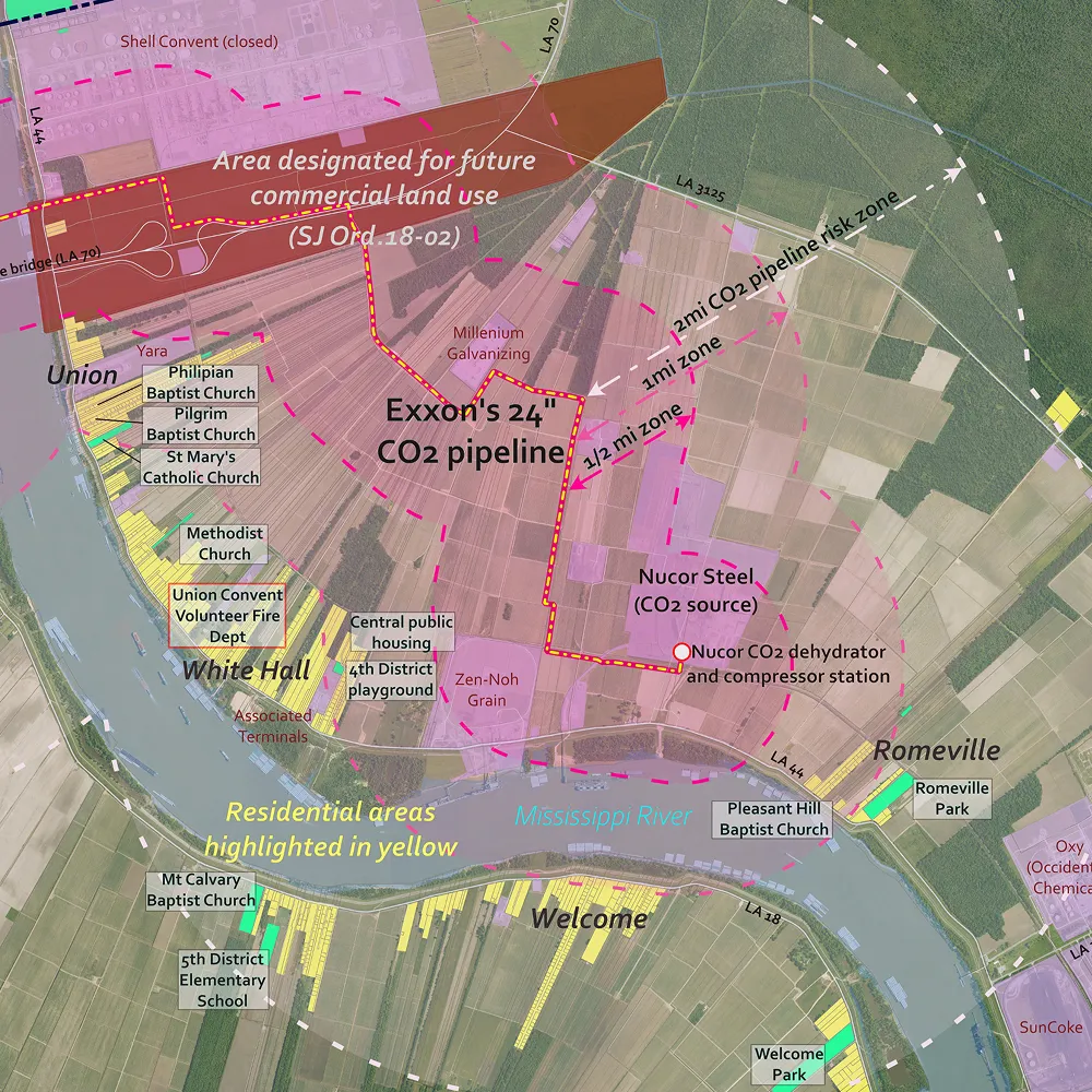
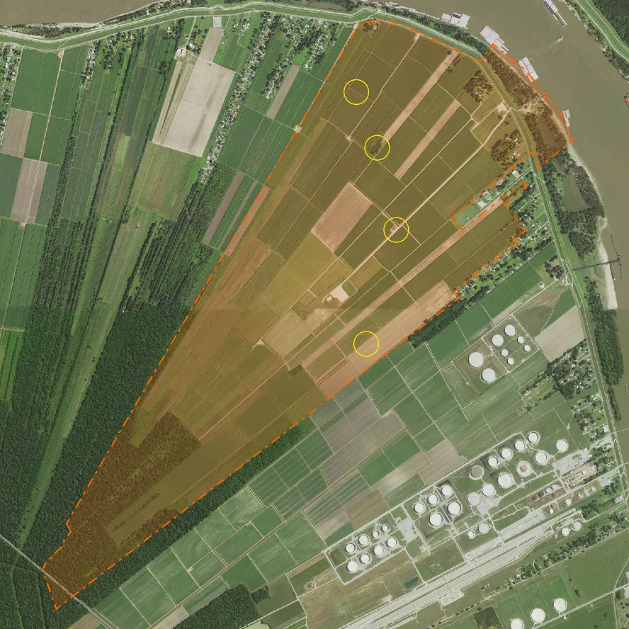
Create map to illustrate proximity risk
Because the pipeline runs through a variety of rural and urbanized areas, the client requested that the proximity to the pipeline be shown at different distances. I chose to show this progressive risk through a series of overlay masks that accentuate the risk color (pink), while preserving legibility of all the features of the natural environment, and highlighting and labelling local landmarks (churches, parks, public facilities, local businesses). I also added in a layer of zoning analysis, showing how the pipeline would conflict with the parish’s own zoning to designate the area for future commercial growth, negatively impacting property values in the vicinity.

Despite opposition, council bows to Exxon
In spite of good public turnout at two planning commission meetings, where hard questions were asked of the application, and scrutiny of the CCS proposal caused the commissioners to fail to vote on approving the project, Exxon applied a pressure campaign to sway the parish council to vote in their favor, ultimately securing a land use permit approval. While parish council did not spend time revealing their reasons for approving the project, which provides fertile ground for speculation as to why they flipped so quickly, In southwestern Louisiana, Exxon has gone to court to force parishes to accede to their aggressive permitting, even causing one parish police jury to fold on an ordinance to ban carbon sequestration underground. Exxon’s dirty tactics reveal that they will operate against the public interest if it suits their bottom line.